The last day of the trip! Going through the pastures of upper land from Villaluenga to Montejaque, then last pass followed by descent to valley of Ronda and up to the cliffs. Will be some 26 kms in lenght, 670 meters of altitude gain, lots of sun and nice views. Link to map
Managed to get up and be back on the road before 8AM (when the local hunters have a licence to shoot).
The first part is a swift descent on the 4WD road to the Llanos de Republicanos.
I can here some rifle bangs from further away and finally I also see the game.
Three black pigs are leiseurly digging the ground some 50 meters by the road.
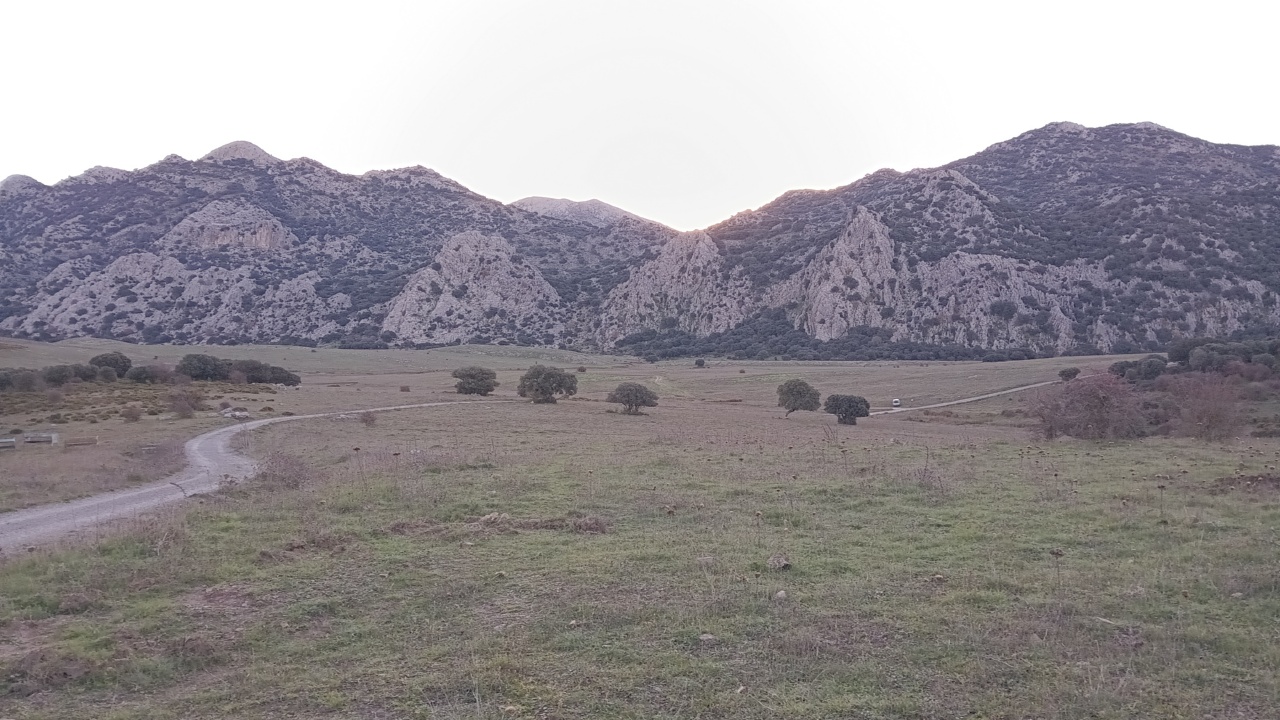 Than I am arrive to the llano, closed valley with a flat bottom.
The route crosses it and then climbs the slopes on the opposite side.
It takes around one hour to get to the pass.
It is still quite chilly as the sun is hiding behind the mounatoin.
Finally at the pass (Passeo de Correo) I greeted with morning sunshine and can get rid of some of the layers.
Than I am arrive to the llano, closed valley with a flat bottom.
The route crosses it and then climbs the slopes on the opposite side.
It takes around one hour to get to the pass.
It is still quite chilly as the sun is hiding behind the mounatoin.
Finally at the pass (Passeo de Correo) I greeted with morning sunshine and can get rid of some of the layers.
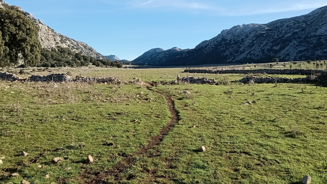 Next, the path descends to a parallel, a bit more narrowe, but even flatter valley.
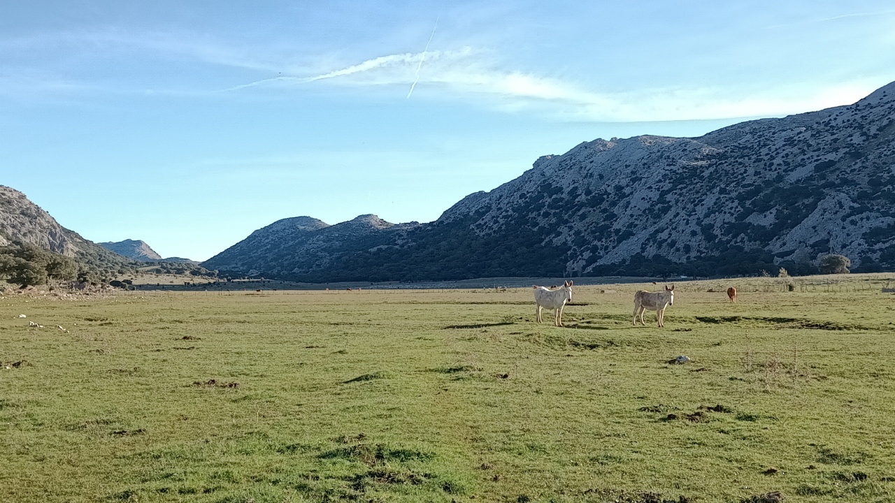
The llano is one big pasture, split into several parts by fences.
The path descends to the pasture, then follows it to the left.
It is not overcrowded here, there are couple of horses here, couple of cows over there, and a lot of grass.
Next, the path descends to a parallel, a bit more narrowe, but even flatter valley.
The llano is one big pasture, split into several parts by fences.
The path descends to the pasture, then follows it to the left.
It is not overcrowded here, there are couple of horses here, couple of cows over there, and a lot of grass.
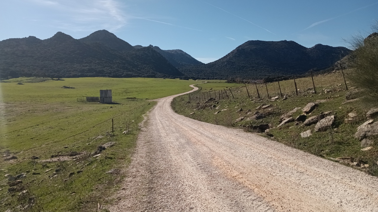
 The path follows the valley for a really long time.
Its not only pasture though, there are some oak groves thrown in the mix as well.
Meanwhile all the morning chill is gone and is short sleeves conditions and even feeling hot.
The path follows the valley for a really long time.
Its not only pasture though, there are some oak groves thrown in the mix as well.
Meanwhile all the morning chill is gone and is short sleeves conditions and even feeling hot.
 Then, after a short rise, the valley narrows and drops down.
The road, flanked by a crag on the right side, and solitary rock towers on the other steeply descends in direction of Montejaque village.
Then, after a short rise, the valley narrows and drops down.
The road, flanked by a crag on the right side, and solitary rock towers on the other steeply descends in direction of Montejaque village.
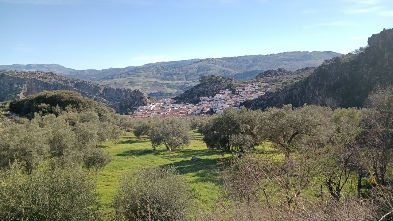 Montejaque emerges from a gorge on a side of a mountain.
From a distance its streak of white houses look like a snow in the mountains which lasts into the summer.
Cold snow.
That would be amazing for both my head and my feet.
When I am there, I have a coffee on a caffee on a dusty road, refill the bottles with water for a last time and start zigzagging to the last pass on my way.
Once I cross it I will be descending into the Ronda valley.
Montejaque emerges from a gorge on a side of a mountain.
From a distance its streak of white houses look like a snow in the mountains which lasts into the summer.
Cold snow.
That would be amazing for both my head and my feet.
When I am there, I have a coffee on a caffee on a dusty road, refill the bottles with water for a last time and start zigzagging to the last pass on my way.
Once I cross it I will be descending into the Ronda valley.
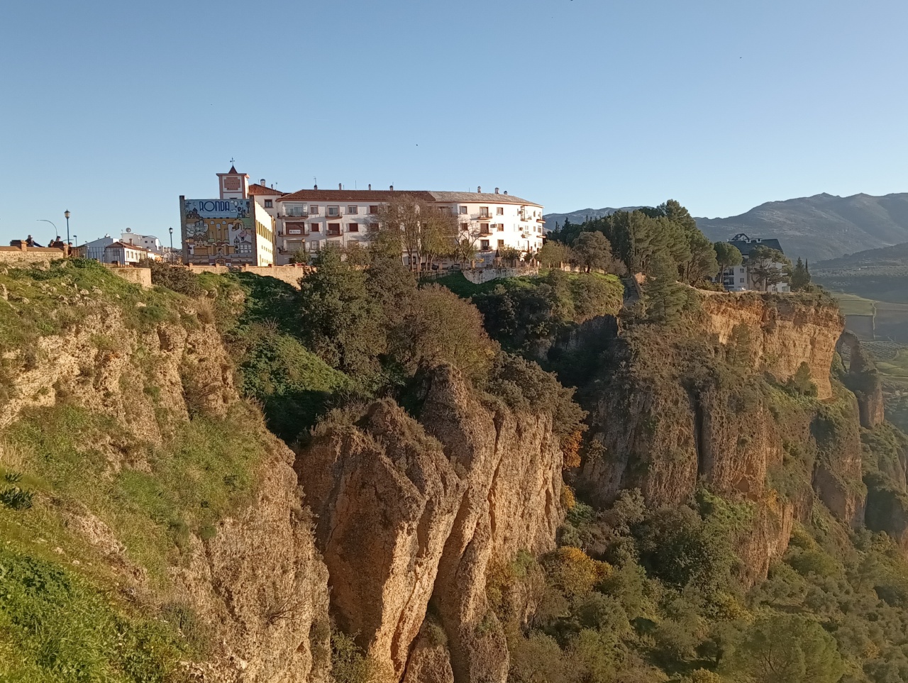
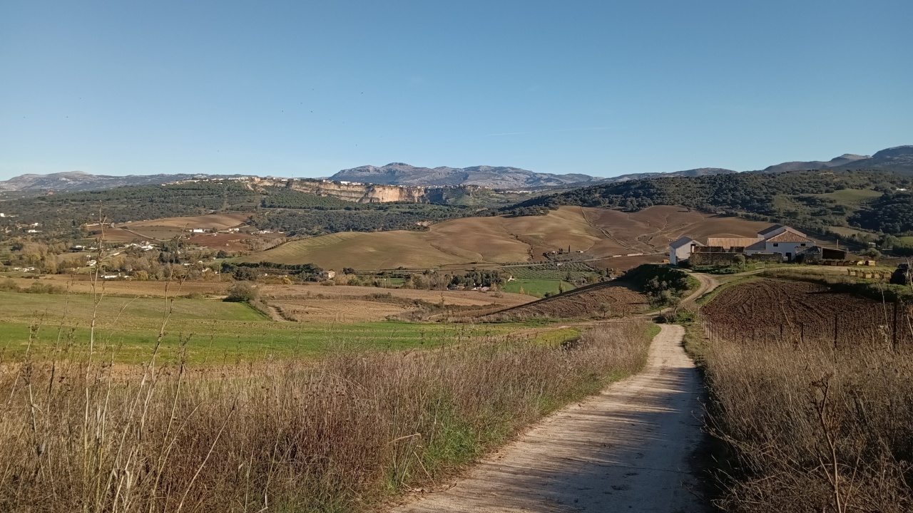 The way out of Montejaque is very short and after crossing the pass, the Ronda valley opens with all its features.
Backed by imposant gray and arid masses of high mountains, its white houses sit comfortably on the ochre coloured cliffs.
Below, the signiture andalusian shades of green and brown fields fill the valley.
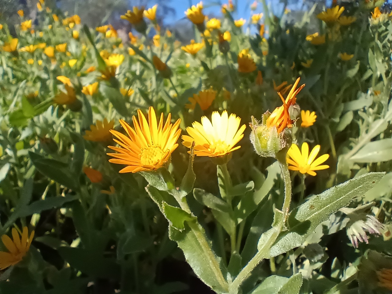
To the right, the apparent homogeneity of the densly wooded mountainside is broken by flashes of orange.
Here are the crags of the gorge I passed through on the first day.
The path drops right down to reach the fields, then travels traverses left and finally down to cross the railroad and rio Guadalevin.
The way out of Montejaque is very short and after crossing the pass, the Ronda valley opens with all its features.
Backed by imposant gray and arid masses of high mountains, its white houses sit comfortably on the ochre coloured cliffs.
Below, the signiture andalusian shades of green and brown fields fill the valley.
To the right, the apparent homogeneity of the densly wooded mountainside is broken by flashes of orange.
Here are the crags of the gorge I passed through on the first day.
The path drops right down to reach the fields, then travels traverses left and finally down to cross the railroad and rio Guadalevin.
 The sun is really strong and its hot.
The water, that just passed through Ronda on its way to Mediterranien Sea is a last chance to cool down tired feet.
Then the path goes up, skirts the left side of the ridge and comes up to Ronda proper.
The sun is really strong and its hot.
The water, that just passed through Ronda on its way to Mediterranien Sea is a last chance to cool down tired feet.
Then the path goes up, skirts the left side of the ridge and comes up to Ronda proper.
I am really looking forward to have a shower but stop on the mirador to watch how the setting sun makes the countryside softer and softer by the angled light.
What a delight.
Next day is a leasurely Saturday.
I watch families and couples to go for the picnic in the olive groves below the cliffs.
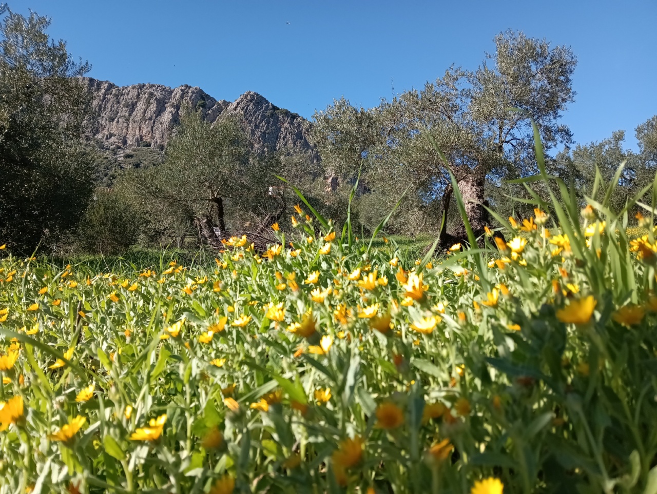 I realize the close connection of the old city to pristine countryside is part of Rondas magic.
There are no layers of boring residential areas, or ugly industrial hangars to pass through.
You can have a good coffee in style and then just drop down to strech yourself on a fresh grass and watch olive branches sway against the deep blue sky.
I realize the close connection of the old city to pristine countryside is part of Rondas magic.
There are no layers of boring residential areas, or ugly industrial hangars to pass through.
You can have a good coffee in style and then just drop down to strech yourself on a fresh grass and watch olive branches sway against the deep blue sky.